Monitor & Analyze


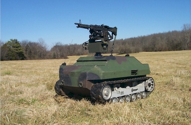
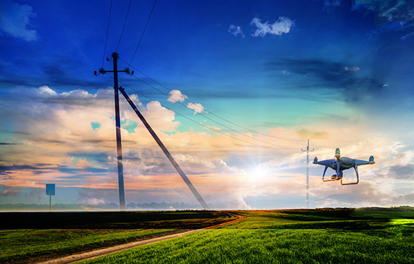
Unmanned vehicles were originally used for missions too dirty or dangerous for humans. Thus, armies quickly found use for these new components.

However, their use rapidly spread to other applications for commercial, civilian, recreational or industrial applications. There is now a very wide spectrum of applications and usages that benefit from these technologies.

Monitor

“See what is not visible, take a look,
while keeping soldiers far from danger.”

Fortunately for the human condition, whatever the field of application, whether it is on the grounds of military operations, in the industry or everyday on the road, the population is less and less accepting of human casualties.

This is why, each situation must be thought of by integrating into it, from the design phase, the greatest sense of operator safety. To do this, in addition to education, training and preparation for danger prevention, it is useful to equip vehicles with various sensor systems allowing real-time, 360 ° observation of the surroundings. These sensors are the operator’s eyes and ears or even hands, which can be deployed where the danger is too great for humans. Autonomous systems (drones, UAVs, UGVs, etc.) equipped with SensUp sensors allow you to accompany you in these missions of monitoring complex environments in each place at all times.


Safety is the primary condition of development.

J.Solana

Archaeology

“Penetrate areas which are not visible”

Light detection and ranging, or LiDAR, has changed the face of archaeology by making it possible to measure and map objects and structures that might otherwise remain hidden.

Our compact and lightweight LiDAR systems are optimized for use with UAVs which can fly over forest canopy, over harsh environments and cover all areas which would be otherwise too difficult to reach for humans. Thanks to their multiple echo capacities, the LiDARs can penetrate areas which are not visible for cameras or other sensors.

This capacity gives unprecedent advantages to archaeologists in their research to explore unknown areas.

Prediction is a very complicated exercise, especially when it concerns the future.

Niels Bohr

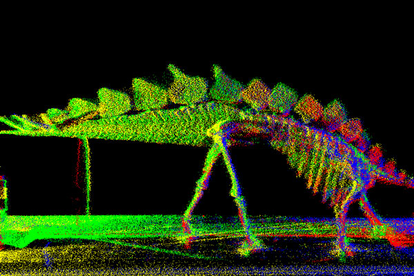
It’s because we need to overcome this difficulty that we must think ahead and find solutions to anticipate a lot of situations in many fields of activity. Take benefit of our advanced sensor solutions to make predictions being easy and safe.

Agriculture

“Respectful agriculture towards our planet”

As our worldwide population rapidly increases overtime, production yields per square meter must continuously be increased.

However, this path must be conducted along with a sense of green agriculture. Our sensors help in relation to a more respectful agriculture towards our planet. The capacity of our LiDAR to detect what is not visible to the eye allows us to determine whether there is a need to alter the ground, and where there is no need.

As one of a particular type of industry, agriculture also needs more and more sensors to optimize yields and safety. Our technology can help as it is reliable and compatible with harsh environments.

Topography & Airborne laser scanning

“The main advance in airborne remote sensing”

The popularization of lidar across disciplines including geography, geology, forestry, archaeology, natural resource management, and urban planning is considered by many to represent the main advance in airborne remote sensing and terrestrial survey over the past decade.

In addition to providing dense data across large areas of open terrain, LiDAR is distinguished from other remote sensing technologies by its ability to provide data from the ground and objects under forest canopy. As a LiDAR sensor is flown over a forest, woodland or scrub landscape area, some return will penetrate the vegetation canopy, reaching the ground, and return to be recorded by the sensor- effectively allowing the creation of terrain models as if there were no forest on the ground.

The method of remote sensing, airborne laser scanning (LiDAR), overcomes some of the physical constraints and allows a real change of scale in the study of forest or urban sites.

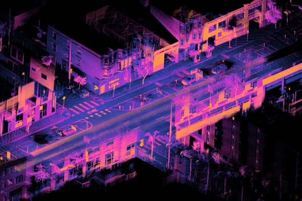
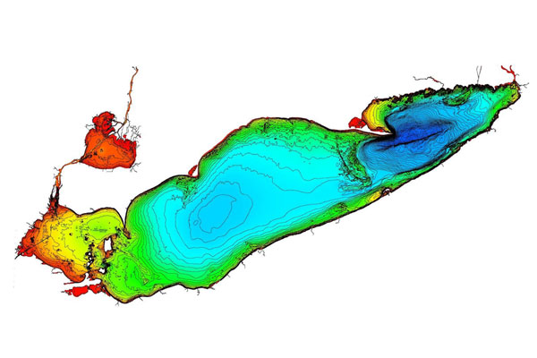
Historically, Mapping represents an essential political issue in terms of unity, but also in terms of control. In Europe, at the end of the 13th century, the science of cartography was reborn on the occasion of great discoveries for the needs of navigation.

Beyond these advances, cartography is gradually becoming a means of holding power and above all, of exercising it. Interest in this discipline peaked in both world wars. In support of military strategies, the accuracy and updating of maps de facto gives an advantage over a conflict zone. Even today, mapping is strategic and the issue of power is being transferred from states to private companies.

Extract from <https://www.franceculture.fr/histoire/de-lantiquite-google-maps-la-cartographie-miroir-du-pouvoir>

Environment

“A popular method of mapping”

Environment needs high tech

High-tech is made of sensors and as such LiDARs and laser range finders can address some of the problems that people working in this field may have to face. As for some examples, one can consider laser scanning as a popular method of mapping flood risk, carbon stocks in forest and monitoring coastal erosion.

Industrial & Maintenance

“Preventive maintenance”

Maintenance is a key factor to productivity in the industry.

Moreover, preventive maintenance is a must as it can help to avoid long periods of production interruptions due to failures. LiDAR helps prevent failures occurring on strategic equipment such as wind farms or high voltage power lines. By scanning the installation with a very high point density, the LiDAR can help to detect micro cracks or rifts. Such a cartography of the installation allows to plan for future maintenance , and prevents stop down of production which could occur due to failure.

Suitable Laser Rangefinders and LiDAR systems

For monitor & analyze